0 ratings

Item #:
86433640
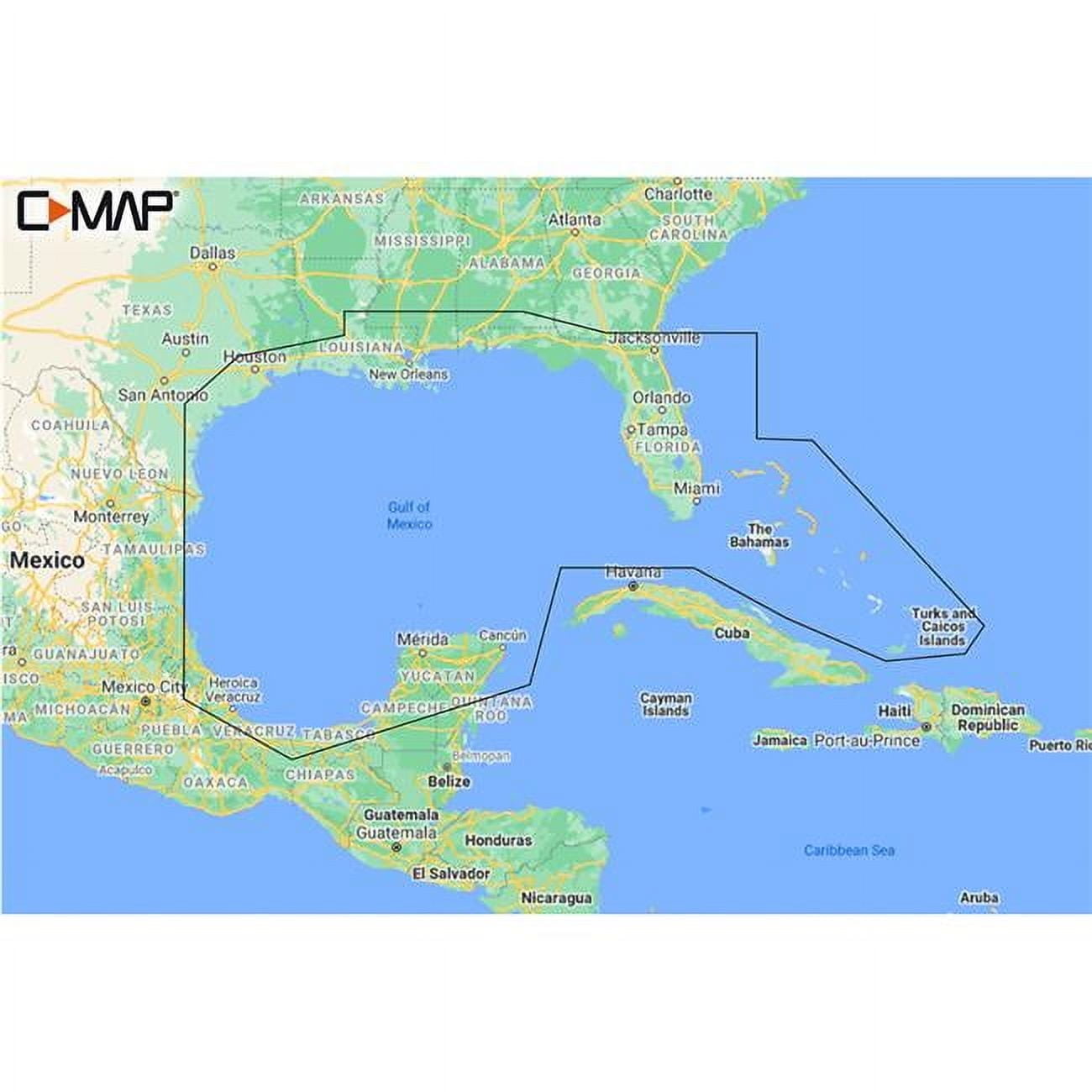
C-Map CMAMNAY204MS Reveal Coastal Gulf of Mexico & Bahamas
Item #:
86433640
MVR 7830
Price Details
Excluding Shipping & Custom charges ( Shipping and custom charges will be calculated on checkout )
*All items will import from US
0 ratings
Write a review
In stock
QTY:
Order now and get it around Saturday, July 04
Secured transaction
Ubuy works hard to protect your security and privacy. Our advanced payment security system ensures confidentiality by encrypting your information during transmission using AES (Advanced Encryption Standards) and SSL (Secure Socket Layer) protocols. Your payment details are 100% secure as we do not share your payment details with third party sellers.
Our Top Logistics Partners
Experience superior navigational features with C-MAP® REVEAL™ for Gulf of Mexico and The Bahamas
Fast
Shipping
Free
Return*
Secure Packaging
100% Original Products
PCI DSS Compliance

ISO 27001 Certified
Note: Step Down Voltage Transformer required for using electronics products of US store (110-120). Recommended power converters Buy Now.


What Stands Out
Detailed Coverage
Provides comprehensive mapping of the Coastal Gulf of Mexico and Bahamas, allowing boaters to navigate with confidence in both familiar and new waters.
Advanced Technology
Utilizes state-of-the-art C-Map technology for precise cartography, enhancing safety and efficiency for both recreational and commercial marine activities.
Easy Updates
Offers user-friendly updates to keep charts current, ensuring that navigational data remains accurate and reliable, differentiating it from competitors.
Product Details
| Map type | Coastal |
| Subject | Gulf of Mexico and Bahamas |
| Features | Water-Resistant |
| Size | Gulf of Mexico & Bahamas |
| Brand | C-MAP |
| Material | Paper |
| Form | Books |
| Finish | Coated |
| Year | 2021 |
| Product line | Maps |
| Edition | Standard Edition |
| Color | Multicolor |
| Color category | Multicolor |
| Accessories | No |
| Assembled product height | 0.2 in (0.5 cm) |
| Age group | Adult |
| Item Weight | 1.5 lbs (680 grams) |
Who Should Buy?

-
Boating Enthusiasts
Ideal for those who frequently navigate the coastal waters of the Gulf of Mexico and Bahamas.
-
Fishermen
Perfect for anglers seeking detailed cartography for fishing spots and underwater structures in these waters.
-
Marine Tour Operators
Useful for operators leading tours or excursions, ensuring safe and informed navigation through coastal areas.

-
Infrequent Users
Not suitable for those who rarely travel these waters and do not require detailed navigation aids.
-
Budget-Conscious Users
May not suit users looking for cost-effective navigation solutions without advanced features.
-
Inland Navigation
Not recommended for users primarily navigating inland waterways, as features focus on coastal routes.
Product Description
C-Map CMAMNAY204MS Reveal Coastal Gulf of Mexico & Bahamas
Have any Query? Chat with us
Customer Questions & Answers
-
Question:
Are the charts updated regularly?
Answer: Yes, the charts come with 12 months of free online updates to keep them up-to-date. -
Question:
Which chartplotters are compatible with these charts?
Answer: These charts are compatible with Lowrance, Simrad & B&G Chartplotters. -
Question:
Do the charts include tides & currents information?
Answer: Yes, the charts show projections of water level and tides, helping in effective planning.
C-MAP Editorial Review
No editorial reviews found
Customer Reviews & Ratings
1 customers ratings
-
5 Star
100%
-
4 Star
0%
-
3 Star
0%
-
2 Star
0%
-
1 Star
0%
Review this product
Share your thoughts with other customers
Pros
- Detailed coastal maps
- User-friendly interface
- Regular updates available
- Great for navigation
- Compatible with multiple devices
Cons
- May have a slight learning curve for beginners.
Product Price History
Important information
- Limitations : For products shipped internationally, please note that any manufacturer warranty may not be valid; manufacturer service options may not be available; product manuals, instructions, and safety warnings may not be in destination country languages; the products (and accompanying materials) may not be designed in accordance with destination country standards, specifications, and labeling requirements; and the products may not conform to destination country voltage and other electrical standards (requiring use of an adapter or converter if appropriate). The recipient is responsible for assuring that the product can be lawfully imported to the destination country. When ordering from Ubuy or its affiliates, the recipient is the importer of record and must comply with all laws and regulations of the destination country.
- Not all the products listed on Ubuy are for sale, as Ubuy is a global search engine. Products are subject to export/trade regulations.
MVR 7830
Order now and get it around Saturday, July 04
This item is not restrict in my country.(Please click on above link if this item is not restrict in your country, So our team will review and allow.)
QTY:
Secured transaction
Ubuy works hard to protect your security and privacy. Our advanced payment security system ensures confidentiality by encrypting your information during transmission using AES (Advanced Encryption Standards) and SSL (Secure Socket Layer) protocols. Your payment details are 100% secure as we do not share your payment details with third party sellers.
Our Top Logistics Partners
Fastest cross-border delivery
Features & Benefits
- Get a lifelike 3D representation of land and underwater elevation
- Accurate, up-to-date vector chart detail from official Hydrographic Office information
- Identify shallow areas, drop-offs, ledges, holes or humps
- Set safety depth, paper-like view, or create custom shading
- Traditional chart look and feel, easy access to all objects on the chart
- Plot shortest, safest route automatically based on detailed chart data